Can technology help model a site in the middle of the forest without impact and, more importantly, do it quickly?
Here’s a challenge: How to survey an area deep in the woods without harming the natural environment in the process and deliver a BIM model of the site in a record-breaking time?
This story follows Helge Gulliksen, a Senior BIM consultant at NTI, as he tackles this unique project. We’ll look into his initial workflow, the successes and challenges he encountered, and how a groundbreaking tool called Environment for REVIT® revolutionized his approach. Through Helge’s experience, we’ll discover how sustainable design and construction practices can be transformed by the power of technology.

The Challenge
Meet Helge Gulliksen, a seasoned BIM consultant at NTI, a software and consultancy firm with over 75 years of experience supporting AEC professionals. Their motto, “No Challenge Too Small,” resonated perfectly with their approach to this unique project. When presented with this particular task, Helge stepped up, although he knew it wouldn’t be a typical build.
“The customer said that he wants to preserve the existing terrain as much as possible,” Helge explains. “Taking environmental impact into consideration is one thing, but this time it was a bit hardcore because the site was deep in the forest.” Preserving the natural landscape wasn’t just a request; it was the core principle behind the entire project. The client, Frode Spernes Svendsen of Løve Eiendom AS, envisioned a house that “floats into the terrain” as Helge described it, minimizing disruption and maintaining the ecological integrity of the forest.
“The client wanted to preserve the terrain as much as possible which was a bit hardcore because we were dealing with a forest“, Helge Gulliksen
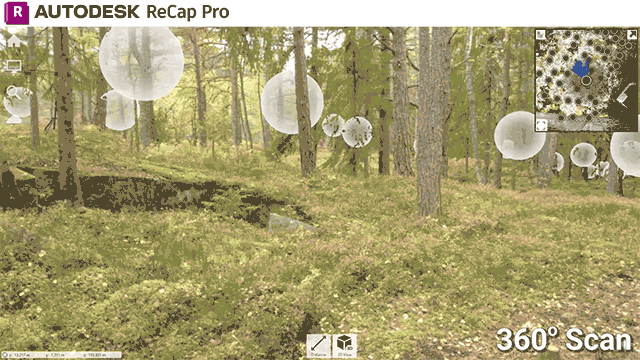
The challenge, however, was immense. Aerial scanning was out of the question due to the density of the trees, and the ground, covered with ferns and shrubs, made it difficult to distinguish between earth and vegetation. Traditional surveying methods often rely on physical intervention, potentially disturbing the very environment they’re trying to map. “That’s why we scanned the forest with a tripod scanner,” says Helge. “That means we had to constantly move it around to cover the entire area from the surface.” This was a time-consuming process because while it was crucial for capturing a lot of data in order to create an accurate point cloud, it was important not to damage the delicate forest floor.
The Old Way vs. The New Way
Helge, familiar with traditional methods, knew the next steps wouldn’t be easy. Creating an accurate digital terrain model (DTM) typically involves a series of time-consuming steps. “We attempted to convert the point cloud into a mesh,” he explains, “but it wasn’t always easy to get a good quality mesh, especially in such a complex area with all the greenery.”
“We also tried using Civil3D to remove trees from the point cloud data, but also that process was excruciatingly slow,” admits Helge, “and even after all that work it offered only little improvement over government-provided surveys in terms of accuracy.”
”I was amazed by the speed, first of all, because this is a huge Point Cloud”, Helge Gulliksen
A New Hope: Environment for REVIT®
Helge was intrigued when he heard about the new tool Point Cloud to Topography by Environment for Revit®. As a plugin, Environment expands Revit’s capabilities for a wide range of outdoor design tasks. “This was a new feature that we hadn’t used before,” he explains, “and to be honest, I wasn’t sure if it would work on such a complex terrain.” Traditional methods had their shortcomings, so the idea of a faster and potentially more accurate solution seemed almost too good to be true. However, Helge was determined to explore its capabilities.
Helge’s initial skepticism quickly dissolved when he put the Point Cloud to Topography tool to the test. “I was amazed by the speed, first of all,” he confesses. “Because this is a huge point cloud, I didn’t expect it to actually work. But I wanted to try it on something extreme – the most complex terrain I had – just to see how good it is.” And to his surprise, the tool generated a topography in only three minutes! In Revit! This was a serious improvement over the hours or even days, it took using other methods.

The time saving wasn’t the only benefit Helge experienced. The Point Cloud to Topography tool streamlined his workflow by eliminating the need for multiple software programs. “At the end of the day,” he says, “I needed a Revit topography for the BIM aspect of the project. The grading and drainage of stormwater, cut and fill and other earthwork calculations.” This tool allowed him to skip all the other programs in the middle. “We can actually modify the topography and monitor the changes in Revit” He continues, “The client has to alter the terrain a bit to build the house, it has to be flattened out somewhere, so he has to see the difference between the existing conditions and the construction phase. He needs to be able to assess how much he’s going to dig out and plan how to bring in machines, heavy equipment without destroying nature.” By working directly in Revit, Frode Spernes Svendsen could effectively plan the construction process while minimizing environmental impact.
“At the end, the client needed a Revit file for the BIM aspect of the project… Revit allowed him to visualize and optimize construction phases while minimizing environmental impact“, Helge Gulliksen
Building in Harmony: Technology for a Greener Future
The story of Helge and the Point Cloud to Topography tool is a testament of the transformative power of technology in promoting sustainable construction practices. This new approach and innovative workflows pave the way for a greener future in the building industry. Minimally disruptive, non-invasive surveying methods capture highly accurate data for BIM models, enabling informed design decisions and optimized construction planning to reduce environmental impact.
Helge, with his extensive BIM experience, recognizes the potential of this feature. As the AEC industry embraces solutions like Environment for Revit®, we can expect more projects that prioritize both design excellence and environmental responsibility.