As the field of landscape architecture is experiencing a technological Renaissance, tools and workflows are emerging to enhance design capabilities, improve collaboration, and optimize project outcomes.
While other software options exist, Autodesk Revit remains the leading choice for landscape architects seeking a digital transformation in their workflow. In its 20-plus years, Revit has evolved from a pure architecture software to a massive multidisciplinary platform, including structural, electrical, and MEP tools, and finally also powerful tools for site and landscape design. In the 2024 release, grading in Revit evolved with the introduction of the Toposolid, a major step forward in the realm of landscape.
To build up on this direction, Revit’s 2025 release expands its functionality with a range of new tools and improvements for terrain modeling. This empowers landscape architects to achieve more efficient site grading, a critical aspect for successful BIM implementation in their workflows. These advancements in Revit provide a fertile ground for the Environment for Revit® add-in, especially for its robust topography editing tools. This combined power elevates Revit to the forefront of BIM solutions for landscape architects and other site designers.
In this article, we will touch on the topic of terrain editing in Revit and explore the available tools. We will try to paint a picture of what native Revit tools have to offer and how they have improved over time, while also introducing the benefits and enhancements provided by Environment for Revit®, which is a dedicated Revit plugin for landscape architecture. With unparalleled flexibility and improved accuracy, this set of tools promises to keep landscape professionals in the AEC tech game, providing greater business value for both designers and firm owners.
THE NEW APPROACH TO TOPOGRAPHY IN REVIT – TOPOSOLID
In the past, Revit represented topography as a triangulated mesh of elevation points, essentially a no-thickness surface reflecting the ground’s top elevation. This common approach, used in many CAD programs for years, offered advantages within Revit. It simplified estimating earthwork volumes by comparing two topographies and provided a clear way to understand the land’s shape through contour lines. This latter aspect is particularly important for landscape designers, as even minor changes to elevation points directly impact the overall topography. In Revit, these changes are immediately reflected on the topography shape and its resulting contours.
However, as AEC technologies evolved, the limitations of this method became increasingly evident. As landscape architects increasingly adopted BIM workflows, the need for new tools more suited to a BIM environment became clear.
To address these limitations, Revit 2024 introduced the new Toposolid category. While it retains the familiar point-based approach, Toposolid offers significant improvements. It allows you to work with material layers and calculate their individual volumes. This shift to a solid element opens up new possibilities for modeling complex elements like tunnels.
Toposolid offers several key features that make it ideal for landscape design, overcoming the limitations of traditional mesh-based approaches:
- Material Layers and Volume Calculations: Assign different materials to layers within the Toposolid. This allows you to calculate the volume of each material separately, like soil layers or pavement structure, for accurate design decisions.
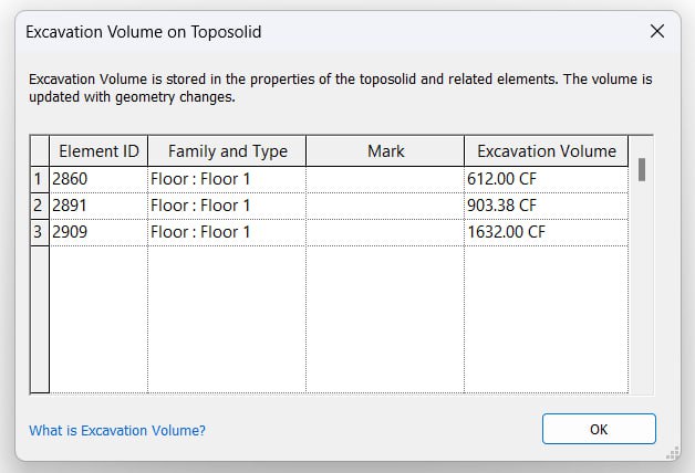
- Boolean Operations: Toposolid interacts seamlessly with other elements. Walls with foundations can cut the Toposolid, providing precise volume calculations. Revit 2025 also introduces an excavation tool that lets you use another ground element (Toposolid or Floor) to cut the terrain and calculate the resulting cut and fill volumes.
- Individual Excavation Calculation: Identify the excavated volume of each element affecting the ground, along with the total net cut & fill for the entire site.
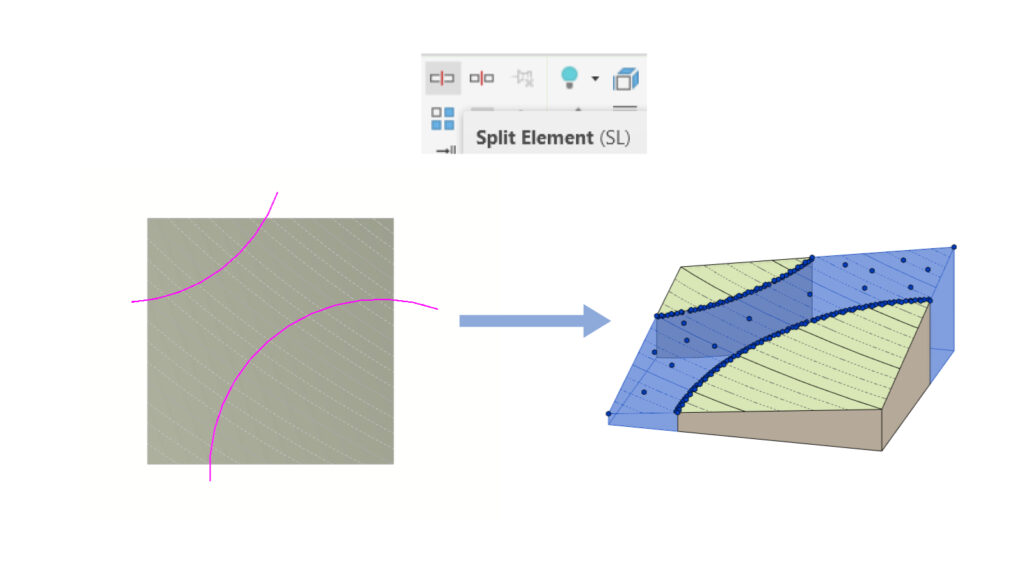
- Flexible Design Workflow: Start with a simple surface and easily split the Toposolid into separate editable elements. This allows for initial conceptual design and gradual refinement as the project progresses.
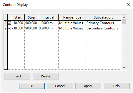
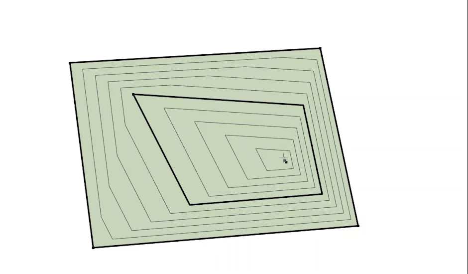
- Dynamic Contour Lines: This is a dream-come-true for landscape designers. Toposolid displays dynamic contour lines that update automatically with any edits. This provides a visual and intuitive design experience. While previous versions offered contour lines, Toposolid offers enhanced control over their graphical representation, where you can control each type of soil separately.
- Fast and Intuitive Modeling: Subdivisions within the Toposolid allow for rapid preliminary design, focusing on function and material representation over precise detail. Revit’s intelligent structure lets you refine the model later for detailed delivery stages.
- Conceptual Design Integration: Design often starts conceptually before detailed development. BIM workflows embrace this approach. Using the “Model by Face” tool, you can easily convert specific areas of your conceptual mass model into a Toposolid with a single click.
This list highlights the benefits of Toposolid for landscape architects using Revit. If you’re a seasoned Revit user, explore this link for more details on new features in Revit 2025 related to site design.
ENHANCE PERFORMANCE WITH ENVIRONMENT FOR REVIT®
Revit’s recent improvements lay a strong groundwork for landscape architects to fully transition to BIM technology. However, when it comes to BIM implementation is such a niche field, industry expertise and a deep understanding of the daily design challenges are required. This is where the Environment for Revit® plugin steps in. Designed by landscape architects, for landscape architects, this comprehensive set of tools tackles, amongst others, the workflows of grading in Revit.
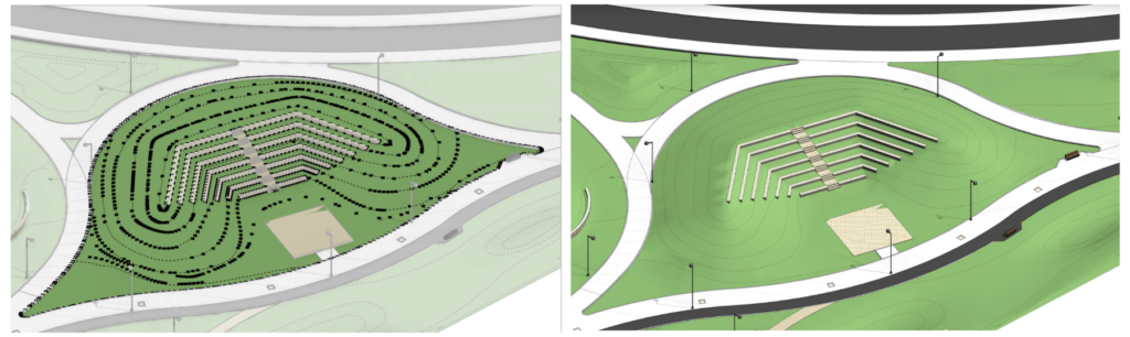
We previously discussed how Toposolid’s point-based structure offers both accuracy and flexibility. However, this accuracy doesn’t come without a price, and often in landscape projects, we find ourselves managing surfaces with thousands of points.
So what can we do to manage these points efficiently?
The Environment for Revit® answers this challenge with its suite of Topography Tools. These tools improve productivity and enhance design flexibility by allowing bulk placement and editing of elevation points, according to your design requirements. You can place points based on desired slopes, connections to other elements, or your overall design intent. Let’s delve into how the Environment plugin transforms Revit into a landscape architect’s dream tool:
Relating to existing or linked elements around the site
Every landscape design starts by understanding the design constraints and existing elements of the site. Be it an entrance to a proposed building or an existing street- with Environment topography tools you can easily connect your topography to the edges of any element in your model. With just a few clicks these tools also allow you to copy the grading from another element and ensure a seamless connection with other designers on your team.
Flexibility to create fluent shapes
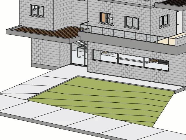
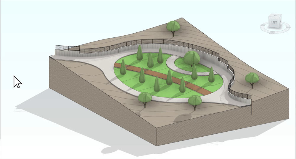
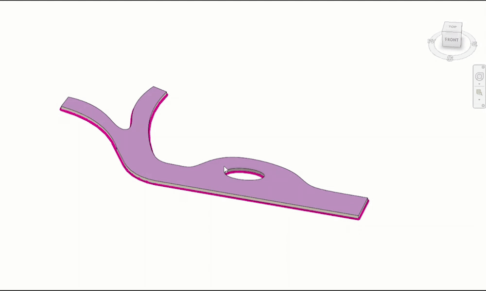
Revit’s topography tools offer high accuracy, which can be great for grading pathways and hardscapes. However, for softer elements like lawns and gardens, you might desire more flexibility. Here’s where Environment shines. With its intuitive set of features, you can effortlessly create those playful, graded areas we all love, just like working with clay.
No need for manual calculation
Grading in Revit can be a time-consuming process that requires a lot of calculations. This is true for most grading software or techniques. However, with Environment’s Topography tools, grading in Revit becomes a fun and fluent process that requires little to no calculation. With these tools you can place many points without having to calculate their height, instead, you can define the desired slope and its direction or create sophisticated interpolations between any two points on your surface. This allows you to create straight or curved lines on your graded surface, all with minimal effort.
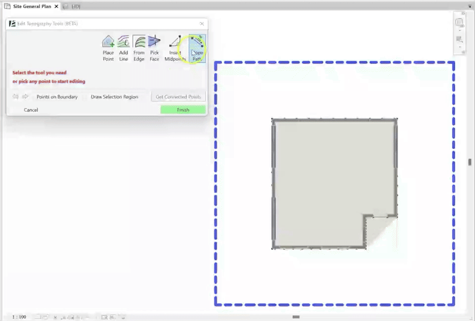
Simplify modeling of complex shapes: Another way Environment for Revit can help simplify your grading process, is by allowing you to control points outside of the boundary of a complex design surface. This grants you greater control over the overall grading of the site.
Interoperability –
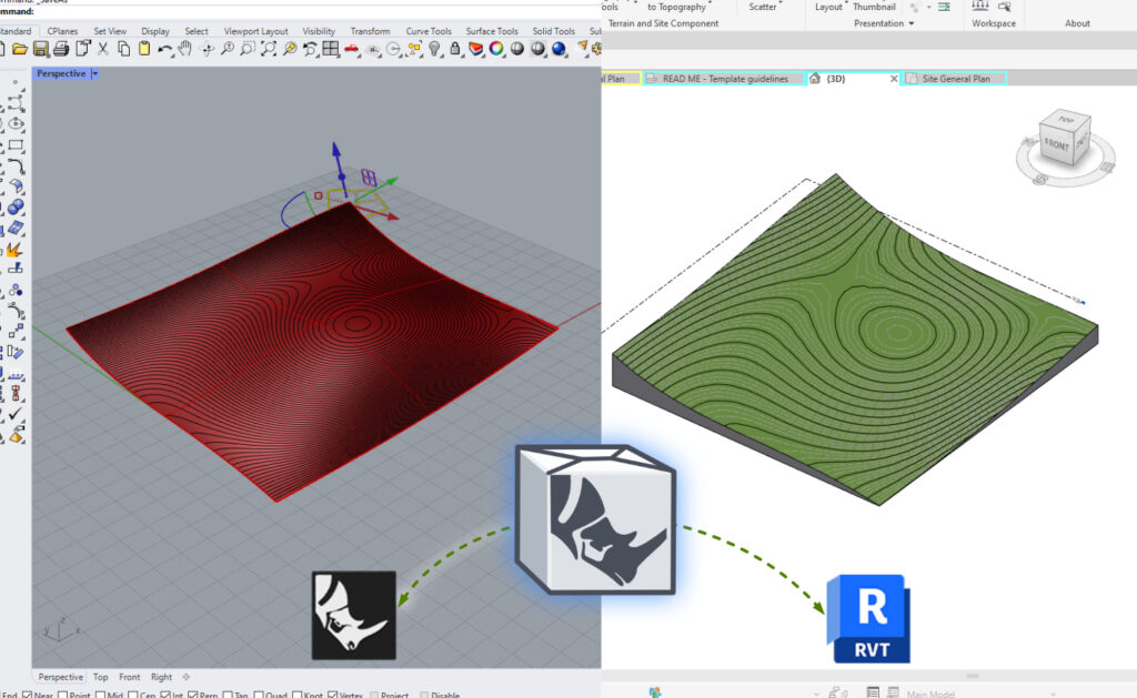
Adding to these benefits, Environment allows you to import elements from Rhino or Civil3D, and convert them into editable Revit Toposolids. This enhanced interoperability is valuable for firms using multiple software programs. Not only do these features save significant time, but they also allow your team to easily collaborate internally throughout the design process.
Take Your Landscape Designs to the Next Level with Environment for Revit®
The recent introduction of Toposolids in Revit 2024 and the ever-evolving Environment for Revit® plugin create a powerful landscape design toolkit. With Revit’s robust foundation and Environment’s specialized tools, you can achieve effortless grading, enhanced flexibility, and seamless collaboration. Ready to experience the difference? Contact us today for a free demo of Environment for Revit® and see how it can revolutionize your landscape design workflow.
Please note: Environment will also support Revit 2025 in a few weeks.